The ChiliView Series - St. George, Utah (KSGU) / Mesquite, Nevada (67L) The ChiliView Series - St. George, Utah (KSGU) / Mesquite, Nevada (67L)
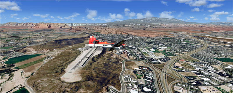
This scenery covers the area between St. George, Utah and Mesquite, Nevada. To the north of St. George the Pine Valley Mountains with their foothills of scenic red sandstone loom over the city. St. George Municipal Airport (KSGU) is mostly used for general aviation but is also served by SkyWest Airlines on behalf of Delta Connection. Because of it's location on a mesa this airport can't be expanded and so a new airport is currently being built southeast of the city at the site of an abandoned airfield. The opening is expected in 2011. To the south of the city make sure, you don't miss the Virgin River Gorge where the Virgin River winds thru a long winding canyon in the transition zone between the red rocks of southern Utahs Colorado Plateau and Nevadas Mojave Desert. Shortly afterwards you reach Mesquite which is situated just west of the Arizona stateline. Like nearly all Nevada cities near the stateline Mesquite is home to several Casinos. Mesquite Airport (67L) lies just north of the city.
It covers a total of 3625 sq km.
For FSX and Prepar3D.
The resolution of 1 m/pix brings you razor-sharp images even near the ground.
Best enjoyed in low and slow operations!
Also contains a 10 m high resolution elevation mesh.
Navigate to neighboring regions:
North
South
East
West
|
!!! BlueSkyScenery needs YOUR help !!!
If you like our sceneries, then please give a little donation.
Your donation makes a difference and helps us to continue this project!
|
Give $1.00:
|
|
|
Give $5.00:
|
|
|
Give $10.00:
|
|
|
Give $20.00:
|
|
Download:
|
FS9 Version:
|
Scenery
|
Airports
|
| |
|
For FSX & P3D:
|
Scenery
|
Airports
|
Scenery Mirror
|
You can support the freeware project by visiting our sponsored links:
|
|
|
All information on this site strictly for simulation use only!
All Trademarks copyrighted. (c) by BlueSkyScenery. All rights reserved.

|
|
|