The ChiliView Series - Zion National Park South, Hurricane (1L8), Colorado City (KAZC) v2.0 The ChiliView Series - Zion National Park South, Hurricane (1L8), Colorado City (KAZC) v2.0
YourDonation@Work: Dedicated to Red Oaks Trading, Volker and Charles. Thanks!
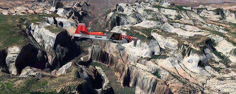
More screenies:
Prev
Next
Covers the southern part of Zion National Park extends south along the cities of Hurricane and Colorado City. Zion National Park is another place where erosion of the Colorado Plateau formed the most beautiful colorful stone formations of unique and wonderful shapes. There are nine different layers of stone visible in the park. Most of them consist of sandstone. But there is also limestone, gypsum, siltstone, shale, clay and mudstone. The Virgin River cut a spectacular and famous canyon thru Zion Park that is as narrow as 20ft and up to 2000ft tall. This is a remake of an earlier release with better and newer imagery.
Notice: The airports also contain the new St.George airport, located southeast of St.George which does not exist in FSX. It has the identifier SGU. The old St.George airport is still available under KSGU.
It covers a total of 3625 sq km.
For FSX and Prepar3D.
The resolution of 1 m/pix brings you razor-sharp images even near the ground.
Best enjoyed in low and slow operations!
Also contains a 10 m high resolution elevation mesh.
Navigate to neighboring regions:
North
South
East
West
|
!!! BlueSkyScenery needs YOUR help !!!
If you like our sceneries, then please give a little donation.
Your donation makes a difference and helps us to continue this project!
|
Give $1.00:
|
|
|
Give $5.00:
|
|
|
Give $10.00:
|
|
|
Give $20.00:
|
|
Download:
|
FS9 Version:
|
Scenery
|
Airports
|
| |
|
For FSX & P3D:
|
Scenery
|
Airports
|
Scenery Mirror
|
You can support the freeware project by visiting our sponsored links:
|
|
|
All information on this site strictly for simulation use only!
All Trademarks copyrighted. (c) by BlueSkyScenery. All rights reserved.

|
|
|