The ChiliView Series - Thermal, Joshua Tree National Park South v2.0 The ChiliView Series - Thermal, Joshua Tree National Park South v2.0
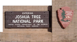
This scenery extends from the southern part of Joshua Tree National Park down to Thermal, Jacqueline Cochran Regional Airport (KTRM) and the Salton Sea, which is the second lowest place in the US and just 5 ft higher than Death Valley. This is a remake of an earlier release with better and newer imagery.
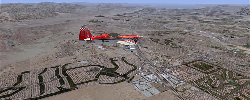
It covers a total of 3625 sq km.
For FSX and Prepar3D.
The resolution of 1 m/pix brings you razor-sharp images even near the ground.
Best enjoyed in low and slow operations!
Also contains a 10 m high resolution elevation mesh.
Navigate to neighboring regions:
North
South
East
West
|
!!! BlueSkyScenery needs YOUR help !!!
If you like our sceneries, then please give a little donation.
Your donation makes a difference and helps us to continue this project!
|
Give $1.00:
|
|
|
Give $5.00:
|
|
|
Give $10.00:
|
|
|
Give $20.00:
|
|
Download:
|
FS9 Version:
|
Scenery
|
Airports
|
| |
|
For FSX & P3D:
|
Scenery
|
Airports
|
Scenery Mirror
|
You can support the freeware project by visiting our sponsored links:
|
|
|
All information on this site strictly for simulation use only!
All Trademarks copyrighted. (c) by BlueSkyScenery. All rights reserved.

|
|
|