The ChiliView Series - Denver (KDEN) The ChiliView Series - Denver (KDEN)
More screenies:
Prev
Next
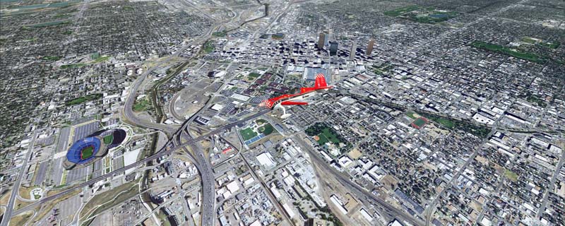
This scenery covers the Denver area. Denver is the capital of Colorado. It is nicknamed Mile-High City because its elevation is one mile (5.280 ft). The sixth RW (16R/34L) of Denver Int'l. Airport (KDEN) is the longest commercial RW in the US with a length of 16.000ft. This allows fully loaded B747's to take off in Denvers mile-high altitude during hot summer days, when density altitudes can approach 9.000(!) ft. The airports distinctive white tent-like fabric roof is designed to be reminiscent of the snow-covered peaks of the Rocky Mountains which you can see on approach or departure. Other important airports covered by this region are Centennial Airport (KAPA), Buckley AFB (KBKF) and Rocky Mountain Metropolitan Airport (KBJC).
The adapted airports for this area are available in the collection of all airports provided by Joop Mak: BSS_AFCADs_0718.zip.
It covers a total of 3625 sq km.
For FSX and Prepar3D.
The resolution of 1 m/pix brings you razor-sharp images even near the ground.
Best enjoyed in low and slow operations!
Navigate to neighboring regions:
North
South
West
|
!!! BlueSkyScenery needs YOUR help !!!
If you like our sceneries, then please give a little donation.
Your donation makes a difference and helps us to continue this project!
|
Give $1.00:
|
|
|
Give $5.00:
|
|
|
Give $10.00:
|
|
|
Give $20.00:
|
|
Download:
|
FS9 Version:
|
Scenery
|
Airports
|
| |
|
For FSX & P3D:
|
Scenery
|
Airports
|
Scenery Mirror
|
You can support the freeware project by visiting our sponsored links:
|
|
|
All information on this site strictly for simulation use only!
All Trademarks copyrighted. (c) by BlueSkyScenery. All rights reserved.

|
|
|