The ChiliView Series - Colorado Springs South (KCOS) The ChiliView Series - Colorado Springs South (KCOS)
More screenies:
Prev
Next
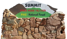
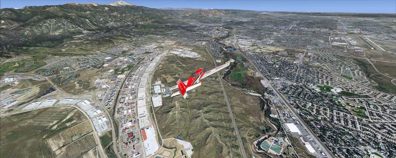
This region covers the southern Colorado Springs area. Just west of the city you can fly around Pikes Peak (14.115ft) which is Colorados easternmost fourteener. Also covers the Fort Carson area, Chayenne Mountain and Canon City.
The adapted airports for this area are available in the collection of all airports provided by Joop Mak: BSS_AFCADs_0718.zip.
It covers a total of 3625 sq km.
For FSX and Prepar3D.
The resolution of 1 m/pix brings you razor-sharp images even near the ground.
Best enjoyed in low and slow operations!
Navigate to neighboring regions:
North
South
West
|
!!! BlueSkyScenery needs YOUR help !!!
If you like our sceneries, then please give a little donation.
Your donation makes a difference and helps us to continue this project!
|
Give $1.00:
|
|
|
Give $5.00:
|
|
|
Give $10.00:
|
|
|
Give $20.00:
|
|
Download:
|
FS9 Version:
|
Scenery
|
Airports
|
| |
|
For FSX & P3D:
|
Scenery
|
Airports
|
Scenery Mirror
|
You can support the freeware project by visiting our sponsored links:
|
|
|
All information on this site strictly for simulation use only!
All Trademarks copyrighted. (c) by BlueSkyScenery. All rights reserved.

|
|
|