The ChiliView Series - Canyonlands NP, Rivers & The Maze/South, Hite (UT03) v2.0 The ChiliView Series - Canyonlands NP, Rivers & The Maze/South, Hite (UT03) v2.0
More screenies:
Prev
Next
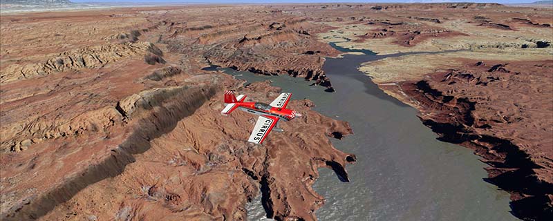
This region covers the area southwest and including the confluence of the Colorado and Green Rivers. From there you can fly down Cataract Canyon which is famed for its premium whitewater rafting oportunities. From there you can see the colorful Orange Cliffs in the northwest. Or explore the Maze (the area west of the Green and north of the Colorado River) with it's labyrinth of canyons and colorful sandstone formations. The scenery extends west to Hite (UT03) on Lake Powell. This is a remake of an earlier release with better and newer imagery.
It covers a total of 3625 sq km.
For FSX and Prepar3D.
The resolution of 1 m/pix brings you razor-sharp images even near the ground.
Best enjoyed in low and slow operations!
Also contains a 10 m high resolution elevation mesh.
Navigate to neighboring regions:
North
South
East
West
|
!!! BlueSkyScenery needs YOUR help !!!
If you like our sceneries, then please give a little donation.
Your donation makes a difference and helps us to continue this project!
|
Give $1.00:
|
|
|
Give $5.00:
|
|
|
Give $10.00:
|
|
|
Give $20.00:
|
|
Download:
|
FS9 Version:
|
Scenery
|
Airports
|
| |
|
For FSX & P3D:
|
Scenery
|
Airports
|
Scenery Mirror
|
You can support the freeware project by visiting our sponsored links:
|
|
|
All information on this site strictly for simulation use only!
All Trademarks copyrighted. (c) by BlueSkyScenery. All rights reserved.

|
|
|